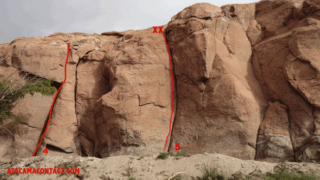
TOPO OF TOCONAO
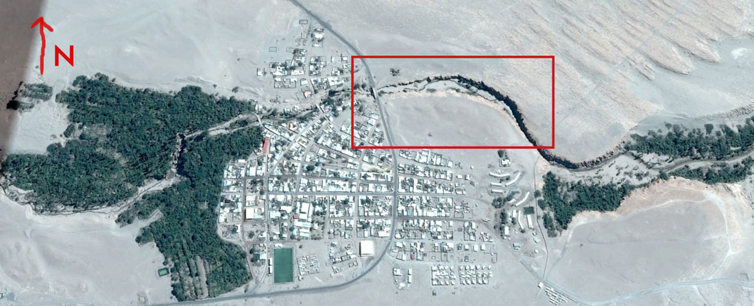
Rock climbing in Toconao
Just 35 km south of San Pedro is a ravine that crosses the village of Toconao. In its lower part there are boulders to climb, and in the high part that we present in this topo we find numerous fissures for climbing with embedded and plates with small holes for sports climbing. The walls are formed by volcanic rocks called ignimbrites and as one walks up the ravine the walls become taller. The ravine has 6 sectors and 35 climbing routes. Take care of the sector, do not leave garbage.
There is a bus that goes to Toconao from San Pedro daily at 9:30 am from the street Licancabur, to return to San Pedro you can try hitchhiking or take the bus at 5:00 pm that passes through the bridge.
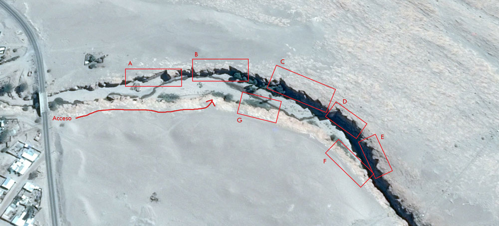
Sectors of High Toconao
The numbers on the north face start from west to east same with the south face.
North Face
- A- Camehouse
- B- El Alamán
- C- Descuelgado
- D- Lado Oscuro
- E- Calentón
South Face
- F- Zona Mágica
- G- Zona Crujiente
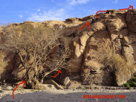
Access to the climb site
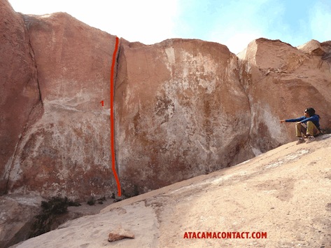
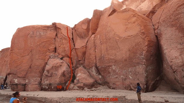
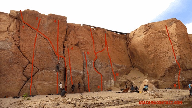
| Column 1 | Column 2 | Column 3 | Column 4 |
|---|---|---|---|
| 1 | 2 | 3 | 4 |
| 2 | 3 | 4 | 5 |
| 3 | 4 | 3 | 2 |
| 4 | 5 | 6 | 7 |
Sector A: Camehouse
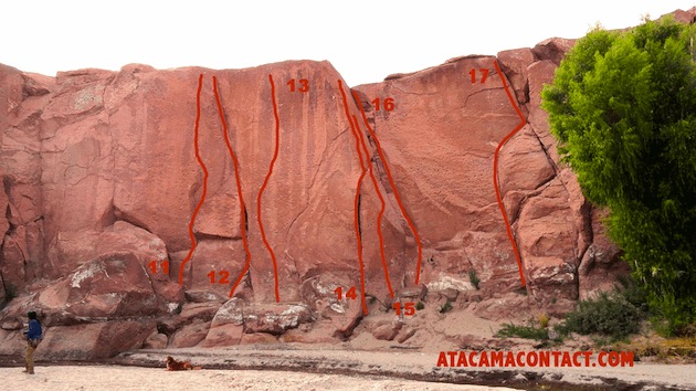
| Column 1 | Column 2 | Column 3 | Column 4 |
|---|---|---|---|
| 1 | 2 | 3 | 4 |
| 2 | 3 | 4 | 5 |
| 3 | 4 | 3 | 2 |
| 4 | 5 | 6 | 7 |
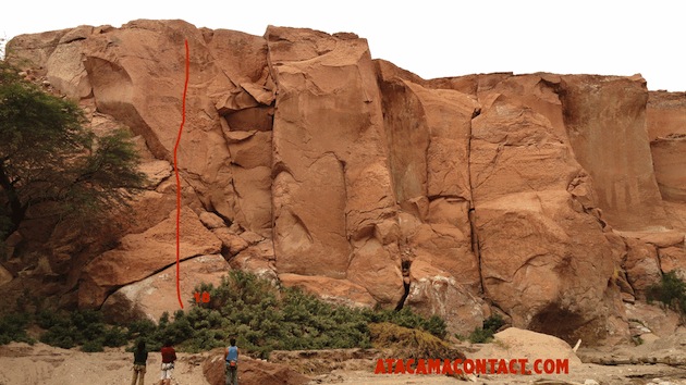
Sector B: El Alamán
| Column 1 | Column 2 | Column 3 | Column 4 |
|---|---|---|---|
| 1 | 2 | 3 | 4 |
| 2 | 3 | 4 | 5 |
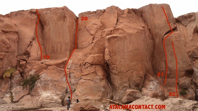
Sector C: Descuelgado
| Column 1 | Column 2 | Column 3 | Column 4 |
|---|---|---|---|
| 1 | 2 | 3 | 4 |
| 2 | 3 | 4 | 5 |
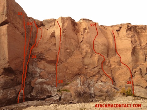
Sector D: Lado Oscuro
| Column 1 | Column 2 | Column 3 | Column 4 |
|---|---|---|---|
| 1 | 2 | 3 | 4 |
| 2 | 3 | 4 | 5 |
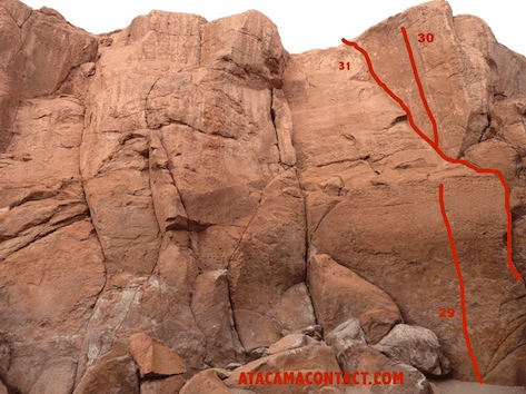
Sector E: Calentón
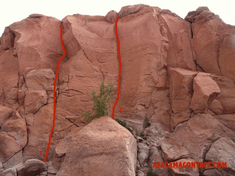
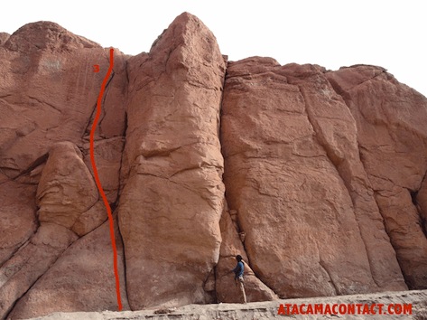
Sector F: Zona Mágica
| Column 1 | Column 2 | Column 3 | Column 4 |
|---|---|---|---|
| 1 | 2 | 3 | 4 |
| 2 | 3 | 4 | 5 |
Sector G: Zona Crujiente